WaveTrax: Can an App Replace the Trusty Ship's Log?
Tired of maintaining an accurate ship's log? Now there's an app for that.
October 1, 2014
Logging and route tracking on boats is a complicated problem to solve well. The ship’s log has been around since the dawn of time, so finding an electronic replacement is like trying to improve the wheel—in a general sense, of course.

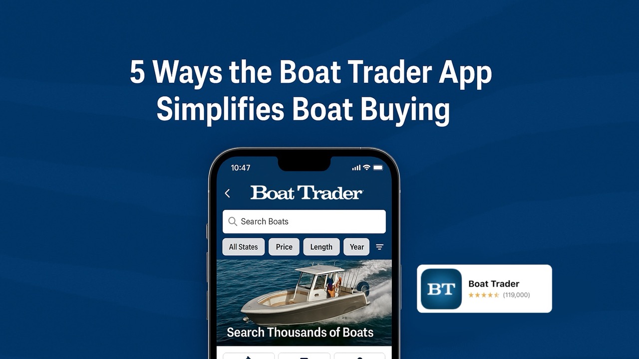
WaveTrax aims to take over the tedious chore of maintaining an accurate ship's log. An iPad or iPhone is all that you need.
Well, a new iOS app called WaveTrax aims to take on the challenge. To get a feel for what it offers, I used the app for a day trip across Puget Sound. To log your route, you simply tap ‘start journey’ on your iPhone or iPad. The app uses the GPS on your device to record your track and mark off waypoints at configurable intervals. Two nautical miles seemed to be an appropriate interval for my sailboat.
The benefit of this electronic logging is that location data is automatically recorded without you having to think about it. Additionally, you can also add annotations, and pictures of places along your route. I probably don’t have to tell you that this is much easier than writing down log entries.
WaveTrax allows you to easily share your route on social media, but only the start/end points are shared, for privacy. I feel as if route log details would be more interesting to share when racing, or when the effect of tides is apparent. My logged routes sometimes look like a mountain road in the Alps! In addition to the basic features, you can also export routes and add vessel information or crew details.
One downside is battery use. WaveTrax runs in the background and requires location services to be turned on, so it continually draws power during use. I found the power draw to be similar to running an external GPS or playing music. It was not significant, overall, but I noticed the battery charge on my iPad mini diminished more quickly than usual—a three-hour trip drained the battery down to about 80 percent.
If you have an iOS device that is Wi-Fi only, you can download map areas before leaving the dock, but you'll need a Bluetooth-compatible GPS receiver to track and log your route. The map is essentially a Google Maps/Earth view, so don’t expect detailed marine charts. I would prefer a simpler map without roads, park details, etc., perhaps with only marina, town, or island names. More detail with full marine charts would be nice, but would also likely drive up the price of the app.

A screenshot of my trip across Puget Sound using the WaveTrax app.
With the companion website, , you can also store and look at your logs on your computer after a trip, and then edit them and add more annotations. This is where I see a lot of potential for the future, especially if WaveTrax adds the ability to insert photos, video, or audio, so I can create a story around my route. With these features, it could become a really useful tool.
Personally, I would give WaveTrax a score of three on a scale of one to five. It’s definitely a good start, but there’s still plenty to do to make it really useful. The app costs $12.99, which includes a one-year subscription to WaveTrax’s cloud. It works on iOS devices and is available in the iTunes Store.