Cruising Compass: August 17, 2001
Welcome to Cruising Compass. The newsletter has been designed with cruisers in mind and offers all who wish to participate a forum for new ideas, personal stories, comments and more. Your contribution
Welcome to Cruising Compass. The newsletter has been designed with cruisers in mind and offers all who wish to participate a forum for new ideas, personal stories, comments and more. Your contributions are welcome. Whether you sail across your local bay or around the world, Cruising Compass is for you.
Cruising Compass is brought to you by Blue Water Sailing magazine. The magazine's editors and regular authors are a rich source of knowledge and information on everything to do with boats, sailing, cruising and the world of voyaging. So, send us your questions and we will do our best to find the answers for you, which we will publish in the newsletter.
Correspondence should be e-mailed to [email protected].
-----------------------------------------------------------------------------------------------------------------
Log Of Mahina Tiare
Heading To The Far North
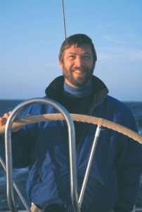
In the last edition of Cruising Compass, we introduced John Neal and Amanda Swan-Neal, who have joined CC as regular contributors. John and Amanda operate Mahina Expeditions aboard their Hallberg-Rassy 46 Mahina Tiare. This summer they, and their expedition crews, have sailed from Sweden to the remote island of Spitsbergen inside the Artic Circle. We join them as they leave Sweden and head for the west coast of Norway. We can't print charts in CC, so you may want to haul out your atlas!
May 21,2001 - 62.21N, 05.22E - Log: 42317 - Baro:1019 mb
Winds: SW 30-39kts - Depth: 150' - Seas: Impressive!
Tearing through twilight! We are ripping along on a broad reach, two reefs in the main, three in the jib. Floro Radio keeps announcing gale warnings, as if we needed a reminder!
This morning we left the tiny, bulletproof anchorage of Vikingsvagen with a cloudless sky and glassy seas. Cliff worked from 2200 until 0400 charting a tortuous route with over 40 waypoints, sliding past some of Norway's spectacular fjords. However, when we crossed Sognfjord entrance we looked out to sea and saw wind. This sparked an idea to sail 140 miles along the coast to Alesund instead of motoring many twisting and turning miles inside the channels. Our goal is to utilize every sailing opportunity to make miles to the north; the weatherfax charts we pulled from Germany, showing that we would get following winds that preceded an approaching cold front, cemented our decision.
In the early afternoon we joked about finding ideal sailing conditions, broad reaching in 15 knots. But the wind kept increasing until grins and rain blew about in the 30s and twilight was a steel gray at 0100.
The expedition has been flying by. We've already sailed 540 miles since leaving Gothenburg. We always ask our expedition members what skills they most want to work on, and four out of the six Leg 1 crew mentioned heavy weather. They didn't have to wait long! We set sail Wednesday morning from Hjuvik on a broad reach. By early afternoon we passed the northern tip of Denmark and the wind, seas and traffic kept building, until by 2300 we had 32 knots, steep short seas that the Kattegut is famous for, and eight ships within the three-mile range on radar.
With following winds we rounded the southern cape of Norway and sailed north, passing Stavanger, before stopping on Friday at Bergen, Norway's second-largest city. We rafted to Bor, an 80-foot traditional gaff schooner, for two nights while crew explored town. The harbormaster came by to collect fees (only $8US equivalent for two nights) and spent an hour marking our charts. As we were missing a few charts, he dropped us at the chart agent in town who had every chart we needed in stock, at only $15US each!
Hey, I've gotta run, we're now in a channel heading for Alesund. On deck, Elizabeth and Amanda are trying to identify lights of the bridge we have to sail under...
... Okay, back again. We got through the bridge without drama and made Alesund by 0700 to enjoy a quiet night tied up in the center of this attractive art-nouveau-influenced city. We met a lively British couple on a Nauticat 35, also sailing to Spitsbergen, and had a Dutch couple on an older Huisman sloop rafted up to us. It was exciting to be exchanging chart and weather info with boats headed the same way!
The following morning we had a blistering downwind sail, jibing our way down twisting fjords with winds touching 40 knots, and just a bit of sleet! The weatherfax charts from Germany showed another cold front about to roar through, so we sailed hard, reaching the tiny fishing village of Bud at 1530. Like so many Norwegian villages, Bud has a visitors' float with an honesty box, $7US equivalent for moorage, including water & garbage. Ashore we explored the remains of the German WWII fort and went for long walks and runs yesterday as we were stormbound with 45-plus-knot winds and breaking seas offshore.
This morning the winds and seas had diminished, so we sailed north, with a brief look around Kristiansted. We will have covered nearly 90 miles by the time we stop in Kongsvoll. Our goal is to get up to the Lofoten Islands relatively quickly so that we can have several days to explore this isolated and dramatic offshore group.
Here's our Leg One crew:
Elizabeth Peter, 51, is a doctor who lives near Vancouver, BC where she and her husband David are preparing their Fast Passage 39 for a voyage to the South Pacific this fall.
Sheryl Howard, 46, is an engineer at Lockheed in San Jose, CA, and a pilot. She sailed a new H-R 39 from Sweden to Florida last summer and she sails her Cape Dory 30 on San Francisco Bay.
Tim Whitlock, 52, works for Timberjack, a division of John Deere in Ontario, and sails his CS 22 on Lake Huron.
John Fink, 46, is a neurologist from Ann Arbor, MI, and enjoys sailing 470s with his six-, 10- and 12-year-olds and his wife Cindy.
Henry Sharpe, 57, recently retired from being a strategic advisor for the mayor and city council of Seattle. He enjoys singlehanding his Alberg 30 out of Bainbridge Island and recently returned from a four-month advisory position with the Vietnamese government.
Cliff Wood, 46, a software engineer from Caldwell, Idaho, enjoys flying his Maule aircraft into back-country mountain airstrips.
-----------------------------------------------------------------------------------------------------------------
Maine Schooner Captain Charged in PWC Gun Incident
Here's the problem: A quiet Maine anchorage, a lovely schooner riding serenely on her anchor rode, a captain enjoying the peace and tranquility of it all... and then a screaming personal watercraft invades the scene and circles the schooner repeatedly. What's a sailor to do? Get out the antique pistol-grip blunderbuss, load up some black powder, and let off a warning blast across the PWC's bow, that's what. (The following report, by John Kettlewell, first appeared in Sounding's Trade Only e-newsletter.)
The US Coast Guard charged a schooner captain who fired an antique pistol to warn off a personal watercraft rider (PWC) in Maine with misconduct and with violation of a law or regulation. Captain Neal Parker, owner of the 20.4-metre, commercially registered, 14-passenger 1912 schooner Wendameen, sailing out of Rockland, Maine, was charged with a violation for possessing black powder without authorization and improper storage of the explosive, said Lt. j.g. Mike McCarthy, a spokesman for the Coast Guard's marine safety office in Portland, according to a report in the Bangor Daily News.
Parker's attorney declined to comment to the paper. Earlier reports said that the Maine Marine Patrol was also investigating, and there was a possibility that the Rockland District Attorney and a grand jury could become involved. The paper reported that no charges had been filed in District Court.
License needed...
McCarthy said, according to the paper, that black powder is classified as a dangerous material and an explosive, and that therefore a license is needed to carry it. The case will be heard in November in US District Court in Portland, according to McCarthy.
Parker's commercial Coast Guard license could be suspended if he is found guilty, the Coast Guard told the paper.
Parker earlier said he had used the pistol as a legitimate warning device in a situation he considered dangerous, as the PWC operator approached his vessel at high speed. Parker said the navigation rules specifically state that a gun is a legitimate signaling device.
In a statement, Parker earlier said, "The fact that I am under investigation with the state of Maine and risk losing my license for using a signal that the Coast Guard's own regulations allow for is totally obscene. Yesterday the investigator told my attorney that the rules of the road did not apply to vessels at anchor!"
"Of course this is nonsense," continued Parker, "but the Coast Guard finds it easier to hang someone who follows the rules than to prosecute someone who does not even show up to answer an inquiry!"
-----------------------------------------------------------------------------------------------------------------
A Different Aspect on Sailcloth?
All sails are not alike: some are tall and skinny, others short and wide. High aspect sails need strong fill performance for high loads. Low aspect sails need bias stability to retain designed sail shapes. Contender Sailcloth produces the highest quality high and low aspect woven sailcloth available. Is it our high shrink warp yarns that draw more fill yarns into a yard of cloth ? Our state of the art looms that pack fibers so tightly there is a minimum of diagonal movement ? Answer: it's both. Whether you're tall and skinny or short and wide. www.contendersailcloth.com
-----------------------------------------------------------------------------------------------------------------
Free Guide to Sailing Adventures
In the July-August issue of Blue Water Sailing, the first annual guide to World Sailing Adventures was published as a free insert. BWS has a quantity of these stand-alone guides in stock and will send you one Free for the asking. The 36-page guide covers bare- and crewed-boat chartering, sailing schools, offshore sailing expeditions and extreme sailing adventures. All you have to do is e-mail BWS at [email protected]. Please allow two weeks for delivery - and make sure you send your complete address!
-----------------------------------------------------------------------------------------------------------------
South Pacific Cruising - The Marquesas At Last
We are anchored in Hiva Oa, cradled in a valley composed of the most amazing green you can imagine. How many shades of green can there be? The Marquesas Islands have them all! The 3,000 miles from the Galapagos took us 20 days and the passage was one of contrasts. The first 1,500 miles were exhilarating. We averaged around 175 miles a day. Then we had a cotter pin fail where our headstay connects to the stem, allowing the clevis pin to back partially out. In the 10-foot seas, we were not able to get the pin back in all the way, though we were able to re-pin it in its halfway position to keep it from backing out the rest of the way. This required that we sail very conservatively, free flying a small jib, until all of a sudden the halyard chafed through, dumping the sail in the ocean in the middle of the night (we got it back aboard).We completed the remainder of the voyage under staysail and mizzen. It became a very slow trip but it was blowing 25 to 30 our last night out so we arrived in fine style.
Some of you may be thinking that 20 days at sea is a long time. It is! But it's richly rewarding as well. We learned some important lessons and we learned some things about ourselves that we can be proud of. We may not have handled everything in the best way but we handled everything. The rest we can deal with here in the anchorage. This was a big crossing for us and it opens exciting new worlds to explore - French Polynesia, every sailor's dream destination.
Dianne & Garland Flournoy
S/V Cornelia Maria
Marquesas Islands, French Polynesia
-----------------------------------------------------------------------------------------------------------------
Letter To The Editor
We participated in the New England 600 Rally this summer, sailing from Annapolis to Camden, Maine, in our Tayana 37. I sent an e-mail to Jim Favors describing briefly our return trip, and I understand that he forwarded it to you. As an addition, I want to let you know how important the Rally was to us in "getting over the hump" and ready to cruise.
Bill (65) and I (62) have dreamed of the cruising lifestyle, and last fall we bought the boat we hope to cruise in. Bill had almost no sailing experience, but has long dreamed of doing this. I sailed as a youth in Scotland, and had a Pearson 27 for five years amid my preparations. I took many Power Squadron courses, and acquired several onboard certifications with the Maryland School of Sailing and Seamanship. I had gained plenty of "head" knowledge, but lacked substantial on-the-water experience.
A year ago, we found out about Nautech and since then we've taken several of their (truly excellent, I can't stress how good) courses. Then we decided to sign up for the Rally as an initial shakedown goal. Without having had the Rally to get ready for, and without the guided experience as a Rally participant in going to Maine, we would NEVER have been ready to undertake and face the challenges of our return trip. And we feel that this definitely has readied us for our long-term dream. We are now advertising our house for rent, and plan to move aboard in a few weeks. We will head south later in the fall, and hope eventually to sail to Scotland. The Rally, and the associated return trip, were without doubt the most valuable training experiences to date. Thanks to Blue Water Sailing for sponsoring Nautech's efforts.
Pat Watt
S/V Callipygia
Tayana 37, Hull #470
Note: The annual New England 600 Rally runs from Annapolis, Md., to Camden, Me., every June. The event is run by Nautech Enterprises (Jim and Marjie Favors) out of Annapolis and is sponsored by Blue Water Sailing. For more information, log onto nautechenterprises.com.
-----------------------------------------------------------------------------------------------------------------
Get Two Issues of Blue Water Sailing FREE
Are you ready to go cruising to the far ends of the earth, or do you like cruising closer to home? Either way, Blue Water Sailing magazine is for you - if you love cruising. Every issue is filled with cruising stories, in-depth reviews of boats, gear and equipment. We offer sound advice on seamanship, navigation and the art and science of sailing a cruising boat. The magazine's regular contributors include circumnavigators Jimmy Cornell, Brian Hancock, Beth Leonard, and Bill Beiwenga - so you know they have the experience to tell it like it is. You can have TWO ISSUES of Blue Water Sailing ABSOLUTELY FREE by logging onto www.bwsailing.com. Look for the 2 FREE ISSUES button.
-----------------------------------------------------------------------------------------------------------------
Weather Analysis - Crossing the North Atlantic in August
As the summer winds down, the last of the boats heading from the East Coast to Europe will be pointing their bows seaward for the 3,000 mile passage. It also happens to be the time when the six Open 60s racing in the EDS Atlantic Challenge are making the return trip from Boston to St, Malo, France (as in, right now). The following weather analysis from Commanders' Weather Services was created for the EDS fleet, but it contains a lot that is of interest to cruising skippers too. In general, the best months for crossing the Atlantic are May through August.
The weather regime in August is often an extension of that in July, especially the first half of the month. The central Atlantic high is often farther north and sometimes stronger and this could present problems with light winds for much of the way back to Europe. This is especially true for the first half of the month. In the second half of the month, there can be some intrusions of more significant frontal systems from the westerlies down into the Great Circle route, but the likelihood of catching one of these and taking it all the way across the Atlantic in mid-August is slight. This route will strongly favor a Great Circle route or close to it.
With the EDS route starting out in Boston, teams are likely to have a SW-W-NW breeze much of the way up to Newfoundland. However, often the central Atlantic high does extend westward to the East Coast of the U.S. and this results in little or no wind to sail with. So speeds can vary from 10 knots to 15-30 knots pending position of the high.
Once teams get east of Newfoundland, it will likely be a case of getting north of the Azores high. Sometimes the high can build to as high as 55N and this would present problems with east winds or no wind along Great Circle. But if the high is to the south between 40 and 50N, teams likely will be able to track north of the high easily. However, prevailing winds north of the high are likely from the west, so lots of downwind sailing and jibing are likely.
Speeds again likely will be quite variable, ranging from less than 10 knots in and near the high to 15-30 knots if teams are dealing with one of the stronger frontal systems. This is more likely late in the month than early to mid-month.
Once east of 20W, teams are likely to be getting east of the Azores high with frequency of winds leaning toward NW and speeds as high as 15-25 knots.
The Tropics...
Of significant concern is the increase in tropical activity occurring in August. Usually the first week of August marks the beginning of the Cape Verde hurricane season. Tropical waves moving off Africa every three or four days are more likely to develop into tropical storms or hurricanes as they move westward south of 20 to 25N. Tropical storms that originate here are often the strongest hurricanes and have the potential to develop into Category 3 to Category 5 storms as they move westward. In addition, storms may also develop near the Bahamas or Gulf of Mexico, but storms in the Gulf of Mexico are not likely to move into the Atlantic in August.
Note - The probability of tropical storm or hurricane development increases throughout the month of August, reaching a peak around 10 Sept. While initially these storms move westward in the tropics, they can often (but not always) re-curve to the N and perhaps NE. This could take them up along the Eastern Seaboard of the US or perhaps farther east into the western Atlantic west of 60W. This curving track is more likely at the end of August than at the beginning, but all eyes should be on the tropics for any departure across the Atlantic in August.
Hurricanes are warm-water storms and as they move north they generally weaken north of 35N into tropical storms; then eventually they lose their tropical characteristics as they move north of 40N. However, they still can bring storm-force to near-hurricane-force winds north of 40N. This is more likely to occur in late August and September than in the first half of the month. So while the chances are slight that teams will have to deal with a full-fledged hurricane, it is quite possible that a weaker system will present some notable problems for teams.
--------------------------------------------------------------------
Send submissions for Cruising Compass to [email protected]
For advertising inquiries contact David McCreary at [email protected]