Path Finder
Leica's MK 40 GPS chartplotter will help you find your way
December 19, 2001
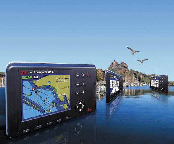
The thin and waterproof MK 40 display and control unit can be mounted in a boat's cabin or cockpit.
Leica's MK 40 GPS chartplotter combines an advanced GPS receiver with built-in C-MAP NT vector cartography and a high-resolution screen. Based on IBM's silicon germanium chip technology, the MK 40 features a 12-channel, high-accuracy GPS receiver board. The GPS receiver, as well as an optional dual-channel DGPS beacon receiver, are sealed inside the MK 40's antenna.
Waterproof and thin, the MK 40 display and control unit can be mounted in a boat's cabin or cockpit. For clear viewing in direct sunlight, the MK 40 has a state-of-the-art, high-resolution, color, flat-panel LCD screen with an anti-reflective coating.
The chartplotter display's a boat's precise position and movement on a C-MAP NT vector chart. Point-and-click operation simplifies course plotting and changing. Routes and waypoints can be uploaded and downloaded to a PC, which makes it easy to store and re-use hundreds of courses.
The C-MAP charts also provide detailed information on tides, port and marina facilities, and more. When integrated with a boat's echosounder, the MK 40 displays depths and bottom contours for instant comparison with charted soundings.
For more information
Leica Geosystems Inc.
23868 Hawthorne Blvd.
Torrance, CA 90505
(310) 791-5300